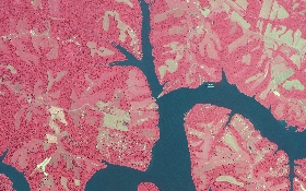
 Mira Solutions’ remote sensing services consist of consulting, acquisition management of digital airborne and satellite imagery, integration with GIS and photo interpretation. Remotely sensed data can be used to monitor urban sprawl, map and inventory wetlands, and delineate wildlife habitat. Once the land cover has been mapped, repeated collection of remote sensing data can be used to monitor and study the various types of habitat and vegetation. Mira Solutions’ capabilities include processing multispectral and hyperspectral imagery for environmental, planning, mineral exploration, agriculture, and telecom to provide informative enhanced imagery and sophisticated maps designed to meet our client’s needs.